
Southwest region · Puerto Rico
Cabo Rojo
~73 mi from San JuanCoastal
Happening in Cabo Rojo
All eventsStarts tomorrowFood & Drink
Traditional Lobster Festival, November 13 to 15
Cabo Rojo is a coastal town on the southwest coast of Puerto Rico, about 73 miles from San Juan. It has 46,876 residents (Census estimate, 2020–2024) and covers 70 square miles, the 7th largest land area of the island’s 78 towns. It forms part of the San Germán–Cabo Rojo metropolitan area and the larger Mayagüez–San Germán–Cabo Rojo Combined Statistical Area.
The town was founded in 1771. Its coastline is the main draw: Playa Los Pozos, Balneario de Boquerón, Playa Moja Casabe, Playa Buyé and Lamela Beach, along with the outdoor site Túnel Guaniquilla. Boquerón also has dining and drinking spots, including Los Remos and Boquerón Brewing Co.
For visitors
Visitors go for the range of beaches, from Balneario de Boquerón to Playa Buyé and Lamela Beach, plus Túnel Guaniquilla and places to eat and drink such as Los Remos.
- Hiking
- Outdoors
- Beaches and water
- Eat and drink
- Fiestas patronales
For living hereResidents live in a large coastal town of 46,876 people on the southwest coast, part of the San Germán–Cabo Rojo metropolitan area and about 73 miles from San Juan.Living in Cabo Rojo: rent, commute, schools & safety
At a glance
- Region
- Southwest
- Setting
- Coastal
- Distance
- ~73 mi from San Juan
- Population
- 46,876 (Census estimate, 2020–2024)
- Founded
- 1771
- Median rent
- $590/mo
- Median income
- $26,408/yr
- Area
- 70.3 sq mi (182.2 km²)
- Fiestas patronales
- Saint Michael the Archangel · September 29
- Guide spots
- 9
- Stories, last 30 days
- 7
- Water & power
- Water by sector · Power outages
- Living here
- Rent, commute, schools & safety
Right now in Cabo Rojo
Road closures in Cabo Rojo
No closures reported in Cabo Rojo as of 1:08 PM AST on Thu, Nov 12.
Water rationing in Cabo Rojo
No rationing plan names Cabo Rojo. None of the plans the Puerto Rico Aqueduct and Sewer Authority (AAA) has published includes the town, as of Nov 12. Repairs and breaks cut service sector by sector: search your sector
Power outages in Cabo Rojo
Not among the 7 towns with the most interruptions on LUMA’s morning reading of Nov 12, when 0.5% of customers island-wide were without power. Cabo Rojo was on that list on one of the last 7 mornings. Outages right now, town by town
Beach water
Within limits: Lamela Beach, Balneario de Boquerón, Playa Buyé and 2 more. Last tested Nov 2.
Beach water qualityNews from Cabo Rojo
Latest stories
Aman Group Unveils Amantaru Resort and Branded Residences at Cabo Rojo’s Esencia
ISER Caribe Plans Marine Education Center for Young Children in Cabo Rojo
Joyuda Prepares to Celebrate Its Traditional Lobster Festival
Cabo Rojo Coop Awards $8,000 in Scholarships to Close Cooperativism Month
Puerto Rico Tourism Company Launches Joyuda and Punta Arenas Gastronomic Route
Our analysis
- Where to Swim · EarlierWhere to Swim This Weekend: Six Beaches, from Vega Alta to Aguada
- Weekend Watch · EarlierPuerto Rico This Weekend: Five Events
- Fiesta Calendar · Earlier8 Patron-Saint Fiestas and 10 Events in September
Every Where to Swim Every Weekend Watch Every Fiesta Calendar
Things to do in Cabo Rojo
Beaches & Chill
Playa Los Pozos
Beach
Playa Los Pozos, also known as Los Pozos Beach, is a beach in Cabo Rojo in western Puerto Rico. It's a straightforward spot for a day at the shore, part of the stretch of coastline that makes Cabo Rojo a popular beach destination in the region.
Balneario de Boquerón
Public beach resort
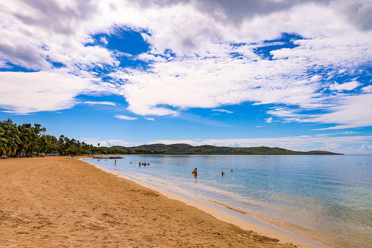
Balneario de Boquerón, also called Playa de Boquerón, is a public balneario in Cabo Rojo run by the Departamento de Recreación y Deportes, with a playground and regularly sampled water.
Playa Moja Casabe
Beach activities
Playa Moja Casabe, also called Playa Aguila, is a beach in Cabo Rojo with a good deal of infrastructure close by. Seven parking areas, a playground and three places to eat or drink sit within a short walk of the sand, so it works as a developed stop for families and groups rather than a remote cove. A boat slipway nearby gives access to the water for small craft, which adds a working-waterfront side to the beach.
Playa Buyé
Natural beach
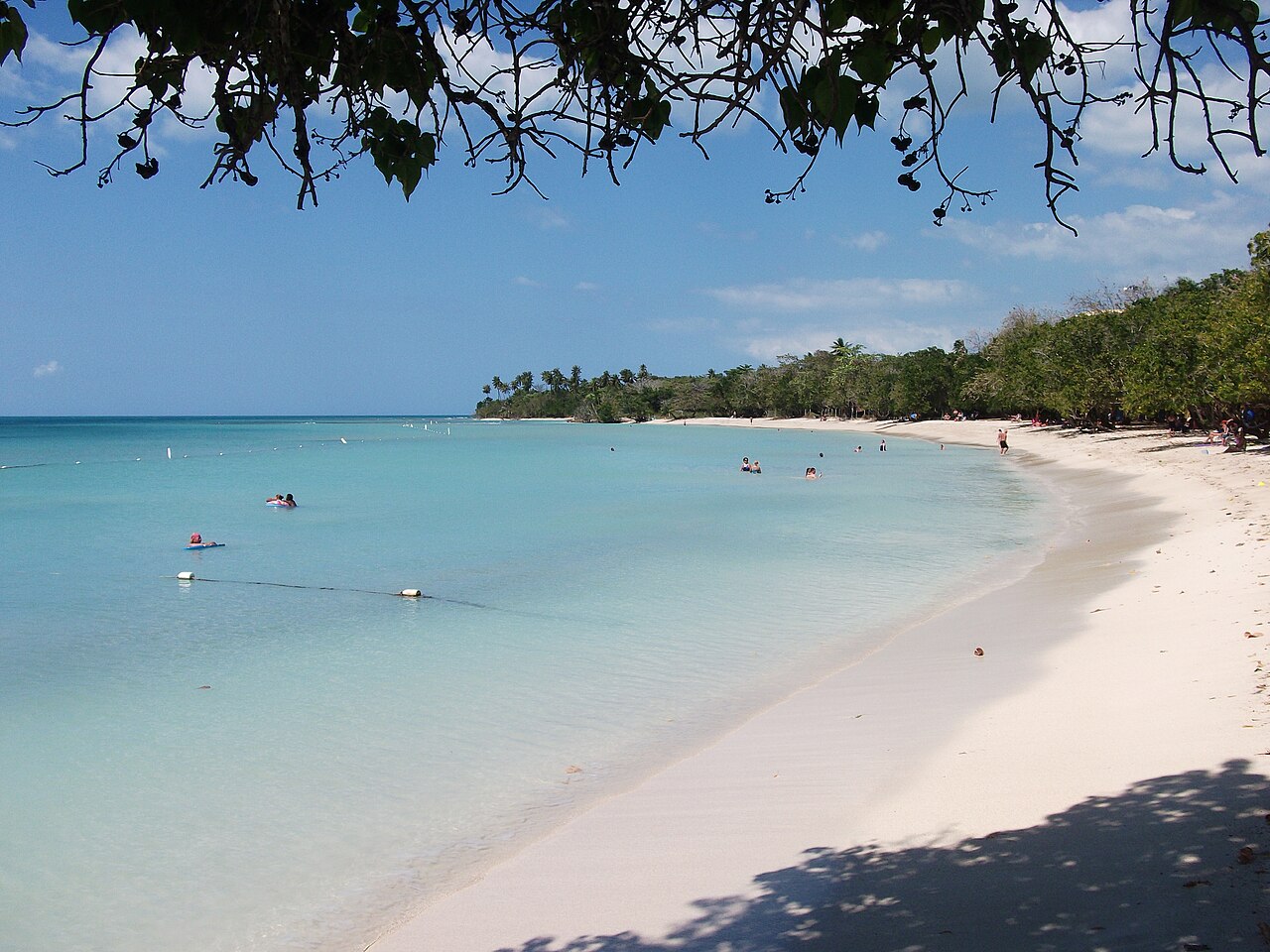
Playa Buyé is a Caribbean beach located in Cabo Rojo, on the south-western coast of Puerto Rico, offering parking areas for visitors. It is a natural beach in the region.
Lamela Beach
Natural beach
Lamela Beach is a natural beach in Cabo Rojo. Its water quality is sampled regularly.
On the Water

Cabo Rojo / Buyé–El Combate
Cabo Rojo / Buyé–El Combate covers the southwestern tip of Puerto Rico, where the water is used for both kiteboarding and diving. Off Buyé and El Combate, clear, shallow flats and reefs give 40–70 ft of visibility, enough for snorkeling and first dives. Between the two, Boquerón Bay has flat water that makes it the place where beginners learn to kite. Kiting runs December through April, when the east-southeast trade winds blow 15–25 knots (17–29 mph). Snorkeling is possible all year.
Nature spots
Túnel Guaniquilla
Hiking route
Túnel Guaniquilla is a hiking route located in Cabo Rojo. The tunnel is part of the local hiking trails.
Eat & Drink
Los Remos
Caribbean cuisine
Los Remos is a seafood restaurant in Cabo Rojo, set on a small wooden pier extending over Boquerón Beach. The pier setting puts diners directly over the water, with views along the coastline while eating. Located on PR-101 in Boquerón, it serves Caribbean-style seafood dishes in this waterfront setting.
Boquerón Brewing Co.
Caribbean-style craft beer
Boquerón Brewing Co. is a brewery at 150 Calle Estacion in Boquerón, founded in 2011 and billing itself as Puerto Rico's first nanobrewery. It brews Caribbean-style craft beer, with each beer named for an island landmark, among them Mar Chiquita and Crash Boat. The Los Morrillos lighthouse, a Cabo Rojo landmark, serves as its logo, tying the brand to the southwest coast where it is based.
Events coming up in Cabo Rojo
Sports
Puerto Rican Sports Hall of Fame Induction Ceremony, November 22
Ramón Emeterio Betances Convention Center (map, opens in a new tab)
Outdoors and sports
On the water in Cabo Rojo
All conditionsOn the water near Cabo Rojo
Marinas, surf breaks, dive sites, wind spots and paddling in Cabo Rojo or within 12 mi of the town center, as the crow flies.
- Sailing6 near
- Puerto RealLanding · in Cabo Rojo
- BoquerónYacht club · in Cabo Rojo
- Puerto Real (Cabo Rojo)Anchorage, basin 6 to 15 ft · 3 mi away
- Diving9 near
- Tourmaline ReefDive site, to 33 ft · 9 mi away
- Black WallDive site, 60–200+ ft · 10 mi away
- ChimneyDive site, 55–70 ft · 10 mi away
- Kite and wind
- La PargueraWorks in E, SE, S winds · 11 mi away
- Paddle
- La Parguera cays and mangrove channelsMangroves · 10 mi away
- Bahía FosforescenteBio bay · 12 mi away
Trails in and near Cabo Rojo
10 trails start in Cabo Rojo, the easiest open ones first.
- In Cabo RojoRefugio de Vida Silvestre BoquerónEasy 2.6 mi each way, 2 h 5 min to 3 h 5 minBoquerón wildlife refugeWalk in, no bookingCommunity-mapped
- Punta Guaniquilla Nature ReserveEl SalitralModerate 0.5 mi each way, 25 to 40 minThe salt flatWalk in, no bookingCommunity-mapped
- In Cabo RojoEl Conuco-Monte del OréganoModerate 1.0 mi each way, 1 h to 1 h 30 minThe farm plot to Oregano HillNot confirmed: ask firstCommunity-mapped
- Punta Guaniquilla Nature ReserveEl TrenModerate 1.1 mi each way, 50 min to 1 h 20 minThe old railwayWalk in, no bookingCommunity-mapped
- Punta Guaniquilla Nature ReserveCamino Túnel de GuaniquillaModerate 1.6 mi each way, 1 h 20 min to 2 h 5 minGuaniquilla tunnel pathWalk inCommunity-mappedTunnel
- Punta Guaniquilla Nature ReservePunta GuaniquillaModerate 1.6 mi each way, 1 h 25 min to 2 h 5 minGuaniquilla PointWalk in, no bookingCommunity-mapped
Bills and recovery money
Bills about Cabo Rojo
- PC 1226Amend Law No. 183-2014Passed a chamber, Nov 11
- RCC 351Traffic System in Cabo RojoPassed a chamber, Nov 2
- RCC 319Naming Bridge in Honor of Víctor Antonio Rodríguez VargasDefeated, Oct 26
- RCS 128Designate PR-301 State Road in Cabo Rojo as Perza Rodríguez QuiñonezPassed a chamber, Oct 9
- RS 459Investigate Water Supply System in Cabo Rojo and Surrounding AreasPassed a chamber, Sep 1
Recovery money in Cabo Rojo
$34.2 million committed by FEMA to 120 projects filed under Cabo Rojo since 2001: $730 per resident, 73rd of 78 towns.
Every project located in Cabo Rojo, the island-wide agencies’ included
41% paid out: Puerto Rico's Central Office for Recovery, Reconstruction and Resiliency (COR3), which pays out the federal disaster recovery money, has paid $25 million of the $60.7 million committed.
41%55.0% paid out on the town government’s own rebuilding: $9.4 million of $17.2 million, the projects it runs itself, as of Oct 14, 2026. Our FEMA story charts this figure for every town.
55.0%- 355v1 Debris RemovalDebris removal$6.4 million
- Rebekah Colberg ColiseumParks and other$5.2 million
- Debris Removal at 100% ShareDebris removal$3.5 million
The town government’s largest projects in implementation, and what has been paid
- Debris Removal$6.4M of $6.4M100%
- Rebekah Colberg Coliseum$2.8M of $5.2M55%
- Debris Removal$3.5M of $3.5M100%
- Emergency protective measures$1M of $1M100%
Every town and the island-wide agencies
FEMA Public Assistance data, as of Nov 11, 2026. Obligated by FEMA: committed to the project and drawn as the work is done. Paid out: COR3’s transparency portal, as of Nov 4, 2026.
Living in Cabo Rojo
Crime in Cabo Rojo
41 violent crimes and 4 homicides reported to the Puerto Rico Police Bureau (PRPD) in Cabo Rojo, January 1 – September 30, 2026; in 2025, 15.6 violent crimes per 10,000 people, in the second-lowest fifth of towns.
- Homicides
- 4 YTD
- Violent crimes
- 41 YTD
- All serious crimes
- 105 YTD
- Violent crimes per 10,000 people (2025)
- 15.6
Flood zones in Cabo Rojo
FEMA’s flood map sets who must carry flood insurance, street by street. Check an address in Cabo Rojo
Phone alerts for Cabo Rojo
Our weekly reads: Daily Water Watch · Grid Watch · Safety Watch
Get the daily email: news, water and power, free once a day.