
North region · Puerto Rico
Manatí
~25 mi from San JuanCoastal
Manatí is a city on the northern coast of Puerto Rico, about 25 miles from San Juan and part of the San Juan-Caguas-Guaynabo Metropolitan Statistical Area. It sits north of Morovis and Ciales, east of Florida and Barceloneta, and west of Vega Baja, with 38,943 people (Census estimate, 2020–2024) spread across more than eight barrios plus the downtown barrio-pueblo that serves as its administrative center.
Founded in 1738, Manatí covers 45.1 square miles along the coast and is known locally for the Mar Chiquita area, a coastal outdoor spot.
For visitors
Visitors come for the coastal setting, particularly the Mar Chiquita outdoor spot on the northern shore.
- Hiking
- Beaches and water
- Eat and drink
- Fiestas patronales
For living hereResidents live in a coastal town with a historic downtown pueblo and easy connection to the San Juan metropolitan area, about 25 miles away.Living in Manatí: rent, commute, schools & safety
At a glance
- Region
- North
- Setting
- Coastal
- Distance
- ~25 mi from San Juan
- Population
- 38,943 (Census estimate, 2020–2024)
- Founded
- 1738
- Median rent
- $538/mo
- Median income
- $22,683/yr
- Area
- 45.1 sq mi (116.9 km²)
- Fiestas patronales
- Virgin of Candelaria · February 2
- Guide spots
- 3
- Stories, last 30 days
- 9
- Water & power
- Water by sector · Power outages
- Living here
- Rent, commute, schools & safety
Right now in Manatí
Road closures in Manatí
No closures reported in Manatí as of 1:08 PM AST on Thu, Nov 12.
Water rationing in Manatí
No rationing plan names Manatí. None of the plans the Puerto Rico Aqueduct and Sewer Authority (AAA) has published includes the town, as of Nov 12. Repairs and breaks cut service sector by sector: search your sector
Power outages in Manatí
Not among the 7 towns with the most interruptions on LUMA’s morning reading of Nov 12, when 0.5% of customers island-wide were without power. Manatí was on that list on none of the last 7 mornings. Outages right now, town by town
Beach water
Within limits: Playa Mar Chiquita. Last tested Nov 3.
Beach water qualityNews from Manatí
Latest stories
Manatí Marist School Mourns 11-Year-Old Student Killed by Falling Gate
Manatí Emergency Chief Identifies 11-Year-Old Girl Killed by Falling Gate
11-Year-Old Girl Dies After Gate Falls on Her in Manatí, Puerto Rico
Man Attacked with Machete Outside Manatí Bar Early Tuesday
Thieves Take $10,000 from a Shell Gas Station in Manatí
Our analysis
- Town of the Week · Last weekBarceloneta, Where Rent Runs 9% Above the Median Town
- Weekend Watch · EarlierPuerto Rico This Weekend: Five Events
- Where to Swim · EarlierWhere to Swim This Weekend: Six Beaches, from Guánica to Manatí
Every Town of the Week Every Weekend Watch Every Where to Swim
Things to do in Manatí
Beaches & Chill
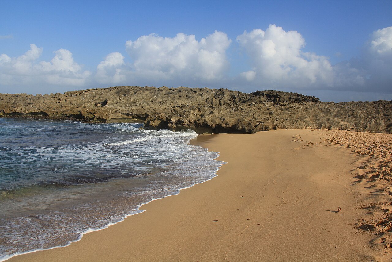
Playa Mar Chiquita
Beach
Playa Mar Chiquita is a beach in Puerto Rico, located in the municipality of Manatí. It has a nearby parking area for convenience.
On the Water
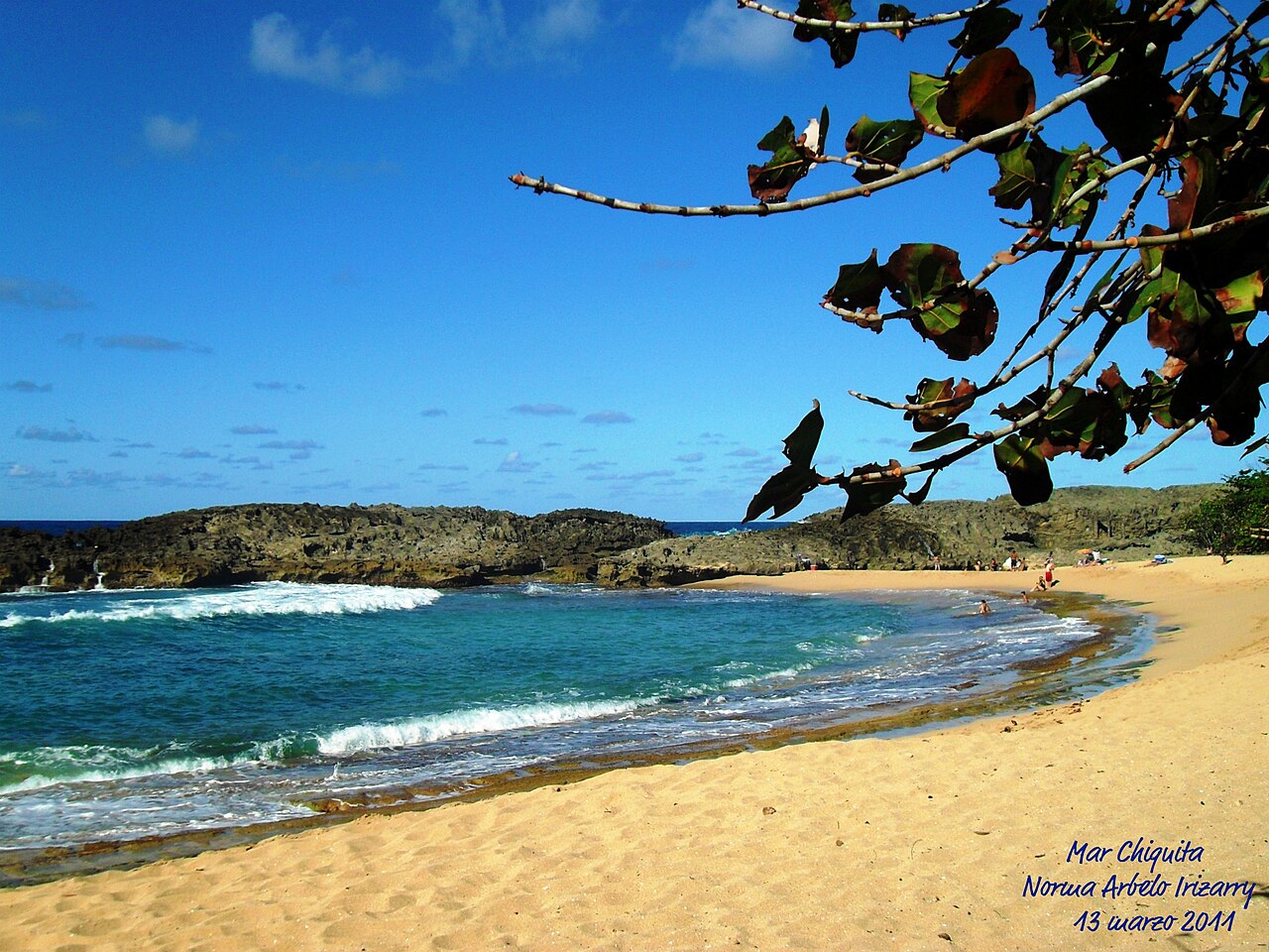
Manatí / Mar Chiquita
Mar Chiquita in Manatí is a horseshoe-shaped cove sheltered behind a narrow gap in the coastal rock, which keeps the water inside calm enough for swimming. Surfers head instead to the outer reefs and the reef breaks at nearby Punta Palmas, which pick up swell from the north and northeast. The surf season runs October to March, when north-northeast swell typically produces waves of 3 to 6 feet on the outer reefs while the cove itself stays quiet.
Eat & Drink
K-Feina
Coffee from Ciales
K-Feina is a café on PR-643 in the hills of Manatí, built around coffee grown in neighboring Ciales and made entirely from Puerto Rican beans. Drinks are served on an open-air deck, so the setting is part of the stop. The kitchen goes beyond the cup with creative breakfasts, brunch plates and pizzas, which makes it workable for a morning meal, a late brunch or a longer sit-down.
Outdoors and sports
On the water in Manatí
All conditionsOn the water near Manatí
Marinas, surf breaks, dive sites, wind spots and paddling in Manatí or within 12 mi of the town center, as the crow flies.
- Surf
- Diving
- Cerro GordoDive site, 0–33 ft · 11 mi away
Trails in and near Manatí
2 trails start in Manatí; the nearest two in other towns are within 12 mi of the town center, as the crow flies.
- Reserva Natural Hacienda La EsperanzaVereda del Río Grande de ManatíModerate 3.4 mi each way, 2 h 45 min to 4 h 10 minRío Grande de Manatí river trailWalk in, no bookingCommunity-mapped
- Reserva Natural Hacienda La EsperanzaLa EsperanzaModerate 7.9 mi loop, 3 h 15 min to 4 h 50 minWalk in, no bookingCommunity-mapped
- Reserva Natural Laguna Tortuguero, Vega Baja, 4 mi awayCaminata por TortugueroEasy 1.1 mi each way, 50 min to 1 h 15 minWalk through TortugueroWalk in, no bookingCommunity-mapped
- In Ciales, 12 mi awayCharco El MorónEasy 0.6 mi each way, 40 min to 1 hEl Morón swimming holeWalk inCommunity-mappedSwimming hole
Sports in Manatí
Local results
Bills and recovery money
Bills about Manatí
- PC 938Amend Various Laws Related to Proclamations and Awareness DaysPassed a chamber, Nov 11
- RCC 385Order Department of the Housing to Develop Model Housing in ManatíPassed a chamber, Nov 9
- RCC 409Name the Manatí Recreational Complex after José Antonio 'El Olímpico' Valentín MéndezPassed a chamber, Nov 5
- PC 1173Designate the 'Taste of the Athens' to PR-685 State RoadPassed a chamber, Oct 26
- RC 474Order Investigation Into Traffic Signal Issues in Legislative District 13Passed a chamber, Oct 6
Recovery money in Manatí
$50.5 million committed by FEMA to 88 projects filed under Manatí since 2001: $1,297 per resident, 59th of 78 towns.
Every project located in Manatí, the island-wide agencies’ included
26% paid out: Puerto Rico's Central Office for Recovery, Reconstruction and Resiliency (COR3), which pays out the federal disaster recovery money, has paid $34.8 million of the $136 million committed.
26%24.8% paid out on the town government’s own rebuilding: $6.9 million of $27.8 million, the projects it runs itself, as of Oct 14, 2026. Our FEMA story charts this figure for every town.
24.8%- Building and EquipmentPublic buildings$8.5 million
- Debris Alternative ProceduresDebris removal$5 million
- MANATI-Hospital, Pharmacy and Ambulance GaragePublic buildings$4.6 million
The town government’s largest projects in implementation, and what has been paid
- Debris Alternative Procedures$5M of $5M100%
- Project PW-01528$251K of $1.2M20%
- Campo Alegre-Parque de Pelota Campo Alegre$870K of $870K100%
- Manati, Centro de Envejecientes Remanso de Paz$166K of $824K20%
Every town and the island-wide agencies
FEMA Public Assistance data, as of Nov 11, 2026. Obligated by FEMA: committed to the project and drawn as the work is done. Paid out: COR3’s transparency portal, as of Nov 4, 2026.
Living in Manatí
Crime in Manatí
46 violent crimes and 1 homicide reported to the Puerto Rico Police Bureau (PRPD) in Manatí, January 1 – September 30, 2026; in 2025, 18.2 violent crimes per 10,000 people, in the middle fifth of towns.
- Homicides
- 1 YTD
- Violent crimes
- 46 YTD
- All serious crimes
- 224 YTD
- Violent crimes per 10,000 people (2025)
- 18.2
Flood zones in Manatí
FEMA’s flood map sets who must carry flood insurance, street by street. Check an address in Manatí
Phone alerts for Manatí
Our weekly reads: Daily Water Watch · Grid Watch · Safety Watch
Get the daily email: news, water and power, free once a day.